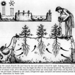
Detail of an engineered landscape in the Bolivian Amazon. Artwork by Clark Erickson.
“In contrast to the Western obsession to drain what are considered marginal wetlands for agriculture, farmers in the Bolivian Amazon may have intentionally expanded wetlands and wetland productivity through earthwork construction, which impedes, rather than enhances, drainage.
The precolumbian farmers did not use causeways as dikes to prevent inundation of fields and settlements, but rather to expand and enhance inundation for agricultural production.
At the same time, impounding water with well-placed causeways and the creation of canals improved and extended the season of transportation by canoe across the landscape. The grid-like structure also permanently marked land tenure in a highly visible manner.”
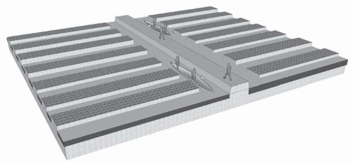
“Causeways are flanked by canals on one or both sides where earth was removed to raise the road platform. Although badly eroded by cattle farming and farming activities, causeways are visible from the air as dark straight lines of trees and bushes that stand out against the grasses of the savanna.
Canals are marked by aquatic vegetation and standing water during the wet season and darker vegetation and soils during the dry season. Causeways range in elevation from 0.2 to 2 m and in width from 1 to 20 m. Most causeways are straight over lengths ranging from tens of meters to kilometers.
Some of the most impressive causeways, canals, and raised fields are found on the Middle Apere River, [covering] an area larger than 60km2 along both sides of the river.”
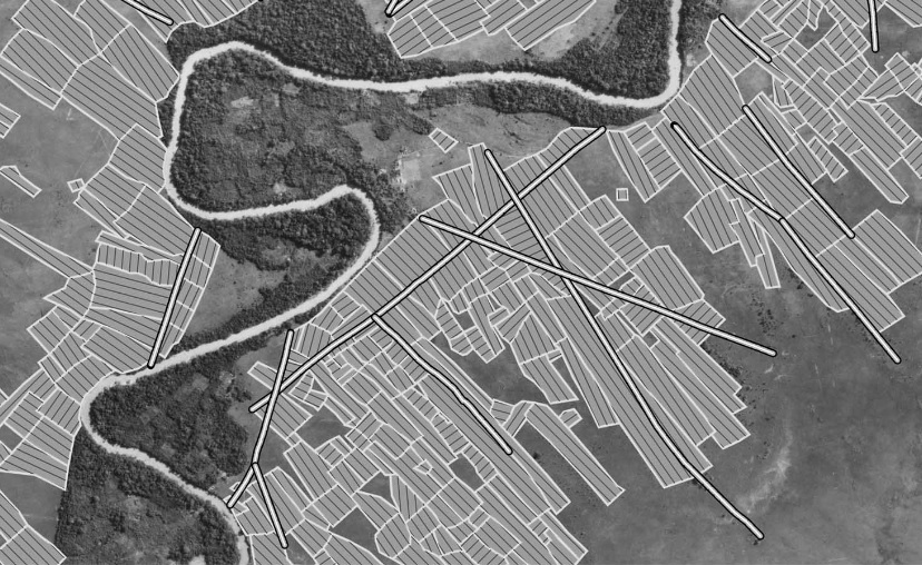
Precolumbian causeways (wide white lines) and raised field blocks (thin white lines) overlaid on an aerial photograph.
“For the precolumbian peoples who built them, these earthworks would have significantly extended growing seasons and reduced agricultural risk. Instead of wholesale diversion of overbank flow from the river onto the levee backslope, the primary hydrological function of the causeways may have been to create local catchment areas where local rainfall and floodwater were harvested for agriculture and the period of canoe access to wetlands during the dry season was extended.
Throughout the year, access to the wetlands for fishing, hunting, and collection of aquatic resources was improved through causeway construction and impounding of water. The resulting expansion of seasonal wetlands on the levee backslopes also improved nutrient capture and production within the blocks of causeways.”
Quoted from: “Precolumbian Causeways and Canals as Landesque Capital” (PDF), Clark L. Erickson and John H. Walker, in “Landscapes of movement: Trails, Paths, and Roads in Anthropological Perspective”, edited by James E. Snead, Clark L. Erickson and J. Andrew Darling, University of Pennsylvania Museum of Archaeology and Anthropology Philadelphia, 2009.