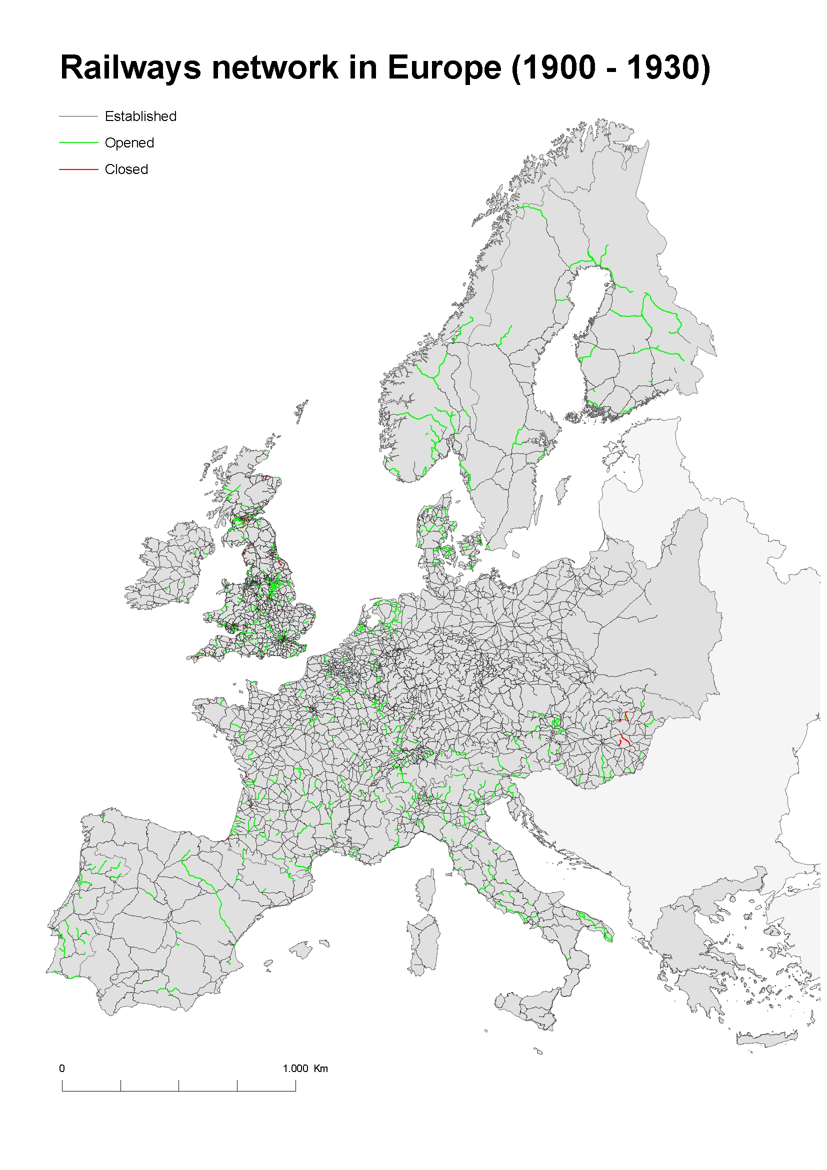
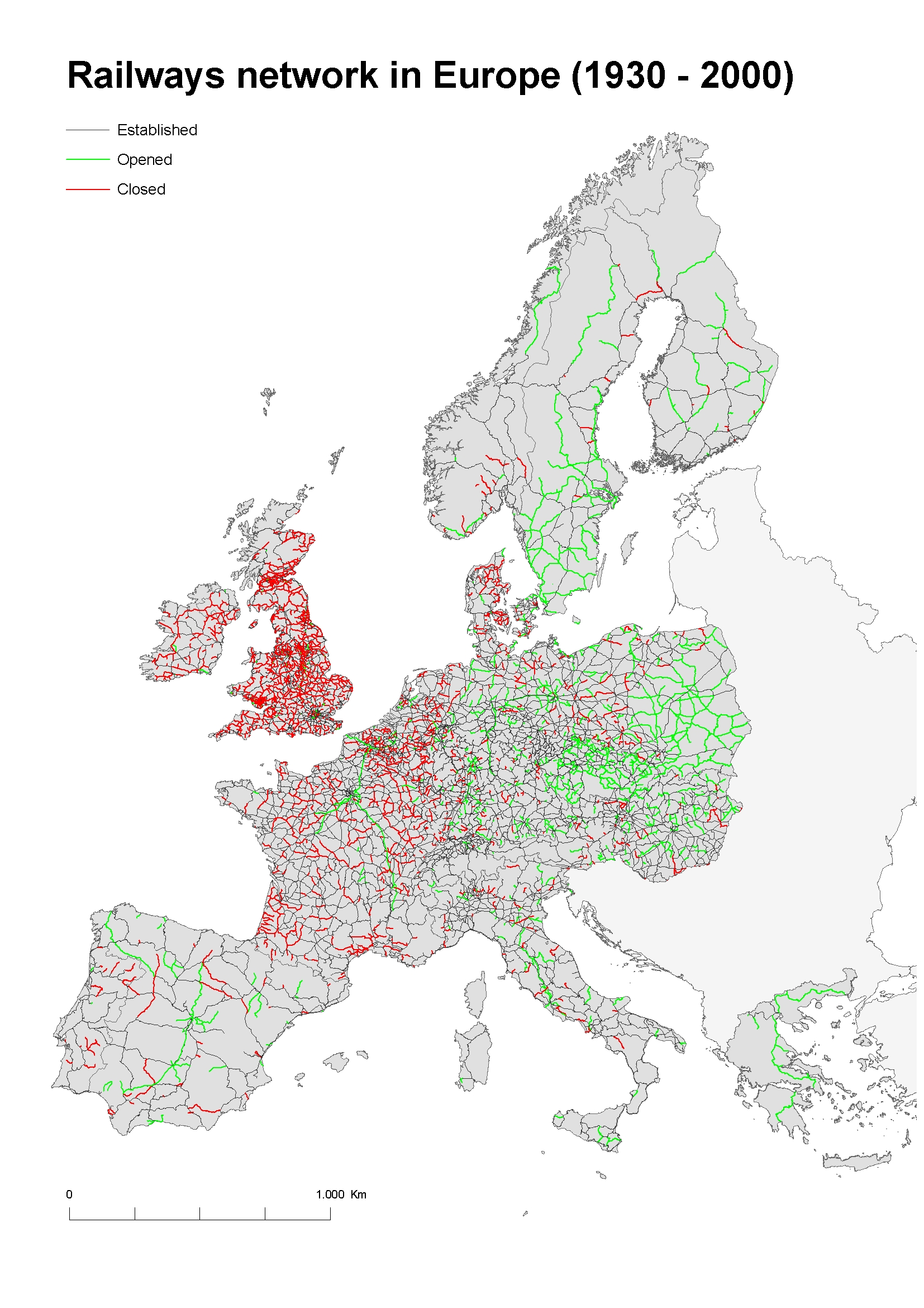
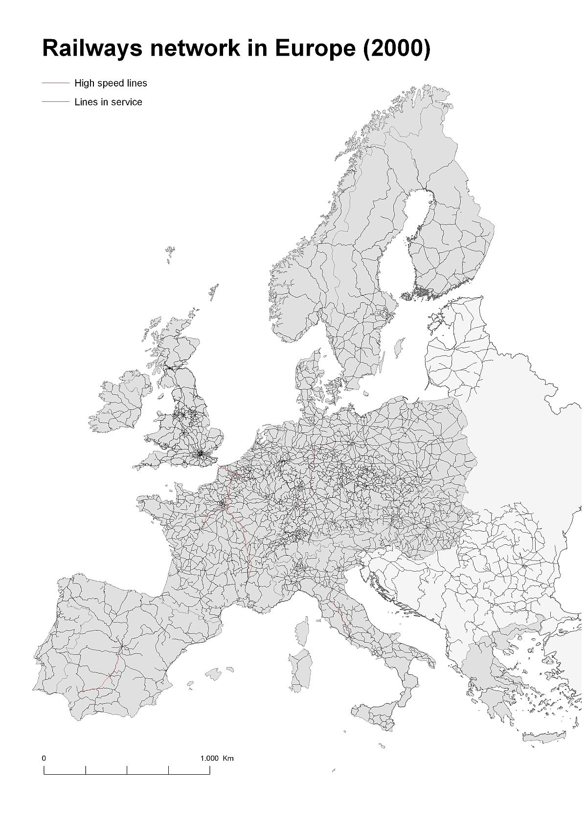
These five maps, based on GIS data and made by the Department of Geography and Sociology of the University of Lleida (Spain), show the evolution of the European railways infrastructure in the 19th and 20th centuries.
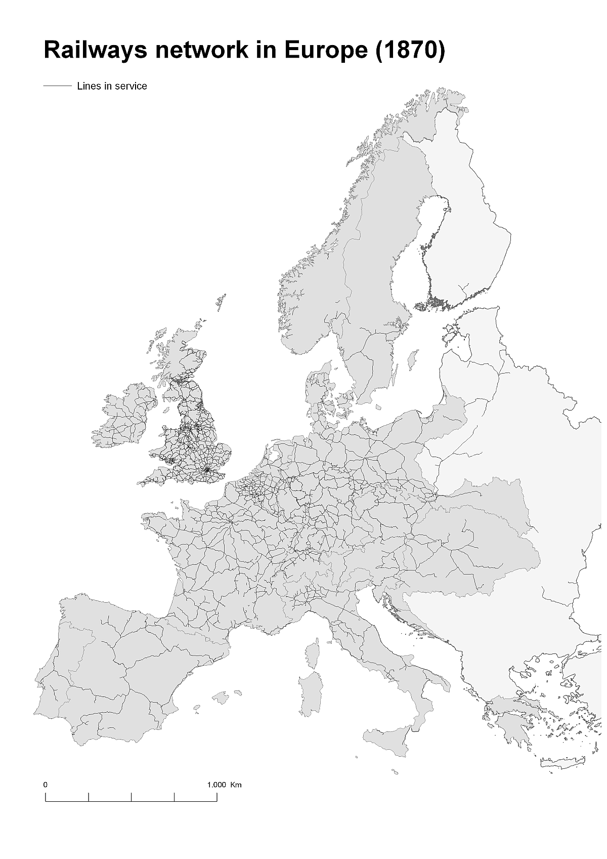
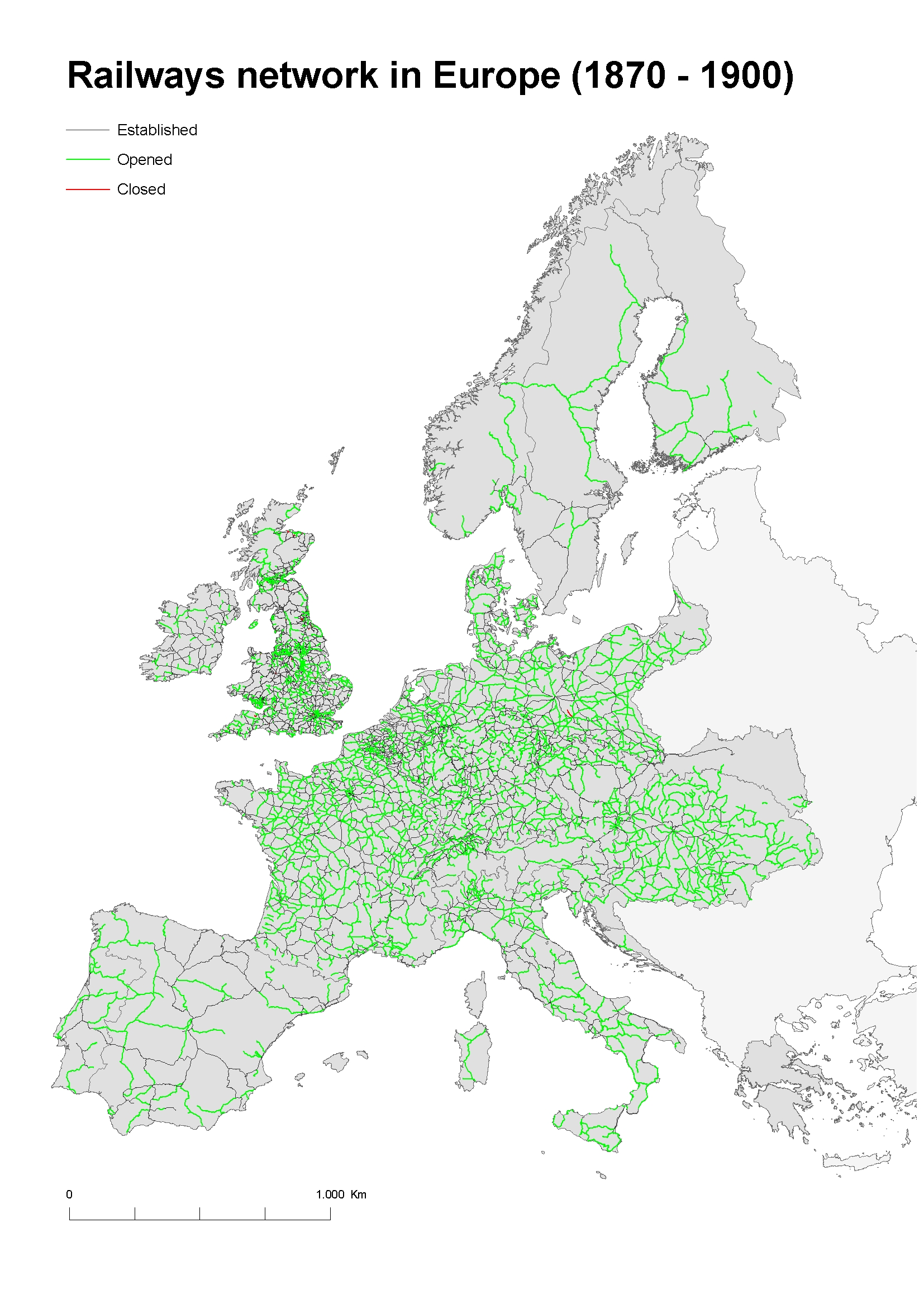
Source: Department of Geography and Sociology of the University of Lleida.
See also: figures on the presence of railways in Europe.
The research team has published some more historical GIS-maps.